Palmer River
Gold Prospecting Location around Palmer River
Looking for a place to give gold prospecting a try around Palmer River?
● Download a simple map that shows areas where you can go and the major roads to those locations.
● Each map is custom made, showing the absolute latest information for any given area.
● Put it on your phone, tablet or computer. No special software required and works without internet connections.
Get This Map
Enter your email and we will create and email you the latest,high-resolution map as a PDF.
We respect your privacy. Your email will not be sold or traded to others.
The Palmer River Goldfield in Far North Queensland is legendary as one of Australia's richest and most remote alluvial gold regions. Often referred to as the 'River of Gold,' this rugged area on the Cape York Peninsula produced over 1.3 million ounces of gold, vast amounts of which were extracted during the frenetic rushes of the 1870s.
Located approximately 200 kilometers inland from Cooktown, the region is defined by its harsh tropical climate and difficult terrain. Today, it remains a site of significant historical interest and active mining, attracting tourists and prospectors to its heritage-listed sites and private fossicking leases.
The Palmer River rush began in 1873 after prospector James Venture Mulligan reported finding payable alluvial gold. The news sparked one of Australia's wildest gold rushes, leading to the establishment of Cooktown as the main port for thousands of diggers trekking inland. Maytown soon emerged as the administrative 'capital' of the goldfields.
The field was unique for its massive population of Chinese miners, who at one point outnumbered Europeans ten to one, peaking at around 18,000. This demographic disparity led to significant racial tension and government regulations. The region was also the site of violent conflict between miners and the local Aboriginal people, who resisted the invasion of their lands.
While the rich alluvial surface gold was largely exhausted by the mid-1880s, the area produced substantial wealth. Attempts at deep reef mining were less successful due to the high costs of transport and the region's isolation.
Today, the Palmer River is a mix of protected heritage areas and active mining. The Palmer Goldfield Resources Reserve protects historic ruins, including the ghost town of Maytown, while active mining leases and stations like Palmerville continue to produce gold and offer opportunities for recreational prospectors.
Common Questions
Where is the Palmer River Goldfield located? ▼
The goldfield is located in Far North Queensland on the Cape York Peninsula, approximately 200km southwest of Cooktown. The area is accessed via the Mulligan Highway and unsealed developmental roads.
Can I prospect for gold at Palmer River? ▼
Yes, but strict rules apply. Fossicking is generally not permitted within the government-managed Palmer Goldfield Resources Reserve (heritage area). However, you can prospect on private mining leases such as Palmerville Station, provided you pay the access fee and hold a valid Queensland Fossicking Licence.
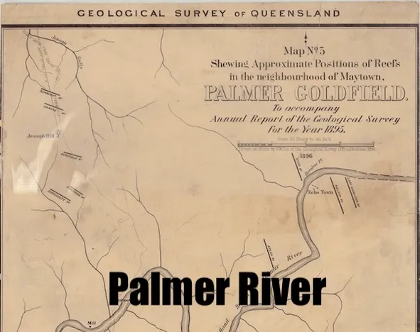
What is Maytown? ▼
Maytown was the main settlement and administrative centre of the Palmer River Goldfield during the rush. It is now a ghost town and heritage site where visitors can see remnants of the era, including stone kerbing, the baker's oven, and old mining machinery.
Why was it called the 'River of Gold'? ▼
The name refers to the incredible richness of the alluvial gold found in the river and its tributaries during the 1870s. It was Queensland's most productive alluvial goldfield, yielding over a million ounces in just a few years.